Welcome
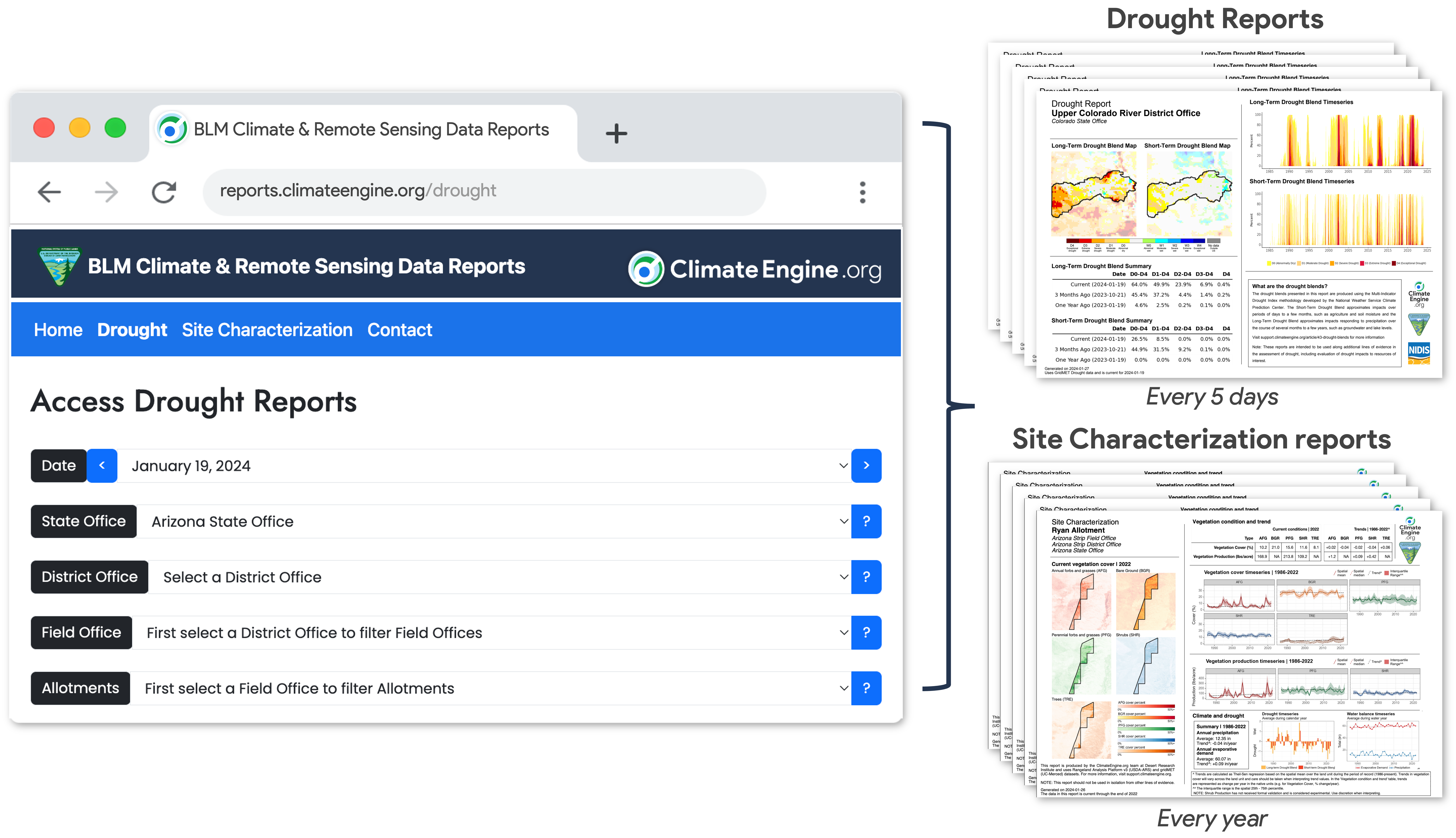
Welcome to the ClimateEngine.org Climate and Remote Sensing Data Reports website—a dedicated platform designed to serve the needs of resource management agency staff and partners by providing reliable and consistent summaries of drought conditions and vegetation status and trends.
One of the website’s objectives is to make large climate and satellite-based vegetation datasets more accessible by providing downloadable PNG and PDF reports to support adaptive management and decision-making. It is essential to emphasize that these reports should not be viewed in isolation. They should be considered alongside other sources of information to ensure a comprehensive assessment of factors such as drought severity and impacts, vegetation condition and trends, and related processes.
The ClimateEngine.org Reports website is the result of a collaborative initiative jointly led by the Desert Research Institute and the University of California, Merced, in conjunction with the Bureau of Land Management. Additionally, NOAA’s National Integrated Drought Information System (NIDIS) has been integral to the development of ClimateEngine.org and the drought metrics provided through these reports, and USDA-ARS has supported development by providing Rangeland Analysis Platform data and guiding the design of the Vegetation Production reports. Our shared aim is to provide reliable and consistent information to support decision-making in resource management and conservation.
Explore the website and contact us at climateengine@gmail.com with any questions.